"To follow in the footsteps of those who went before us and to leave a clear path for others to follow."
  • Home
  • Services
  • Our Team of Professionals
  • Request For Services
  • Projects
  • Contact Us
  • Links
  • Blog

Why Are Boundary Surveys So Expensive ?

6/14/2011

27 Comments

 
Picture
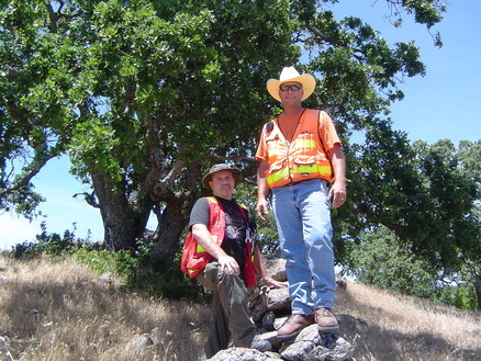
Steven Heise -PLS and Dustin Jones- LSIT,boundary survey in Santa Clara County, California
     This is one question I seem to be hearing more and more lately, “Why are boundary surveys so expensive?” Understandably, this is one of the more common questions and there are a number of reasons. In most cases the time spent "behind the scenes" acquiring record information, researching deeds and maps, compiling field and record evidence, calculations, drafting, and preparing reports and deed descriptions can far exceeds the time spent on the site making actual field measurements and finding monuments. Now, that being said, it is the responsibility of the Land Surveyor to find existing monuments and to make an exhaustive search to locate any known record monuments, before re-establishing boundary lines. The answer to boundary surveys seldom lie in the math, it is the Land Surveyors responsibility to resolve the boundary holding the intent of the original record that created the property. This ratio between time spent on the site and time spent on research, in the office and around the site varies depending on several factors. For example, a small lot with several abutting properties may require less field time to locate boundary evidence because of the relatively close proximity, but may require the same amount of off-site work as a much larger parcel, or vice versa.  It may take a day to find and locate field evidence, and 4-6 days of the "behind the scenes" work to complete the survey. There are countless legal and boundary principles to apply, verify and check before completing the survey.

     The cost of a boundary survey can depend on so many of the variables of the property being surveyed; size, shape, terrain, vegetation, and the amount of existing survey records in the area. The surveying process can be very similar to placing pieces in a puzzle. The first step in the process is to obtain copies of all the survey records and deeds in the area of your property. This can take several hours and depending on the age of the documents even days. The Land Surveyor is required to look at all adjoining properties, right-of-ways, and water boundaries, easements, street closures and dedications, to determine how your piece of the puzzle fits in with the adjoining pieces. Given a legal description of the property and all adjoining properties, the Land Surveyor locates the property on the ground. Once the fieldwork is completed, a Record of Survey Map is prepared that will be recorded at the County Surveyors Office. Each County Surveyors Office also requires a fee to record the survey. This fee is paid by the client directly to the County and is generally in addition to the fee for services charged by the Land Surveyor for his work.

     In most cases a Land Surveyor's hourly rates are at or below hourly rates of similar Professions and are more in line with that of tradesmen such as carpenters, electricians, plumbers, and auto mechanics, none of whom assume anywhere near the kind or amount of liability a Land Surveyor does. If a tradesman makes an error, he will likely be required to go back and fix the resulting problem. The resulting problem from a Land Surveyor's error may be a multi-million dollar commercial building being built in the wrong location, or a costly legal battle with an angry abutting property owner. Rarely can a Land Surveyor simply return and fix the problem resulting from an error. The Land Surveyor is a Licensed Professional and it is his responsibility to find the best resolution of the property boundary, which will hold up under the scrutiny of Law. After all property disputes are well documented throughout history and can easily be found or studied in Boundary Case Law.  Our courts decide countless boundaries annually. The role of the Land Surveyor is to Monument the legal boundary on the ground and through a recorded instrument, which justifies the procedures and principals used to support his findings.

     The cost of a boundary survey in California is a very small percentage when compared to the price of the land being surveyed. The liability assumed by the Land Surveyor is for that piece of real property.  So, when choosing your Land Surveyor please make sure that he is covered by a Professional Liability Insurance Policy and use the California Department of Consumer Affairs Board For Professional Engineers, Land Surveyors, and Geologists - License Look Up website to check his status, here is the link: http://www2.dca.ca.gov/pls/wllpub/wllqryna$lcev2.startup?p_qte_code=ENG&p_qte_pgm_code=7500.

     It is my intention to help you understand the role of the California Licensed Professional Land Surveyor and the scope of services he provides.


27 Comments
Dustin Jones
7/1/2011 05:40:42 am

Very well written and informative.

Reply
Clark Stoner link
9/8/2011 06:02:31 am


Nice work. Way to spread the word.

Cheers.
Clark Stoner
Land Surveyor
Civil Engineer
Santa Cruz County

Reply
Oscar Patterson link
1/19/2013 10:58:39 pm

A surveyor must always begin a project with fairness in mind. Your consumer moreover as everyone party concerned within the project is expecting you to be truthful and with great care build the most effective attainable assessment with the evidences bimanual to you.

Before a project commences, the surveyor assigned to the project ought to act if there’s an opening of conflict of interest. this is often vital to preserve their relationship with the consumer. A surveyor ought to avoid skilled impropriety by declaring involvement or any previous affiliations with any of the concerned parties. it's additionally the surveyor’s responsibility to stay any info relating to the project moreover because the consumer confidential even when the project is completed.

Reply
hannah neilson link
4/30/2018 03:14:49 pm

I agree that you want to consider the cost of a land surveyor. It would be smart to consider this because it would ensure that they are qualified. My husband and I are looking for a land surveyor, so we'll have to consider the cost.

Reply
Jordan link
6/6/2018 01:42:08 pm

We've been looking for a few good surveying services, and I think that some tips would be nice. I'm glad you talked about how variables on the property can help change the price. I'm going to have to look for a few good surveying services and see what we can find!

Reply
Elsa Anderson link
6/7/2018 05:10:29 am

I never knew until you elaborated that boundary surveyors are responsible for making investigations, research and gather records of the actual measurement of the land you own, as well as knowing its previous owners. It makes sense because only then you can determine your actual territory to avoid future lawsuits of those who would contest your ownership. If I were to buy a piece of land, I will not make any hesitations to hire a boundary or land surveyor to do all the thorough checking for me.

Reply
Skyler Williams link
11/6/2019 07:24:22 am

Thank you for explaining that some of the factors that go into the cost of getting a survey are size, shape, terrain, vegetation, and the number of existing survey records in the area. My sister wants to build a warehouse on some land she wants to buy but she needs to get a survey first. I'll pass on this information to her so she can decide if she wants to get a survey.

Reply
Austin Saunders link
1/30/2020 08:15:37 am

It's good to know that the cost of a boundary survey depends largely on the size of the property. My sister has been telling me about how she wants to make sure that the fence she gets installed is installed right on the edge of her land. I'll share this information with her so that she can look into her options for getting a property survey done.

Reply
Mike Sanders link
4/27/2020 07:34:21 am

It's good to know that the cost of a land survey can depend on things like the amount of vegetation. My sister has been telling me about how she wants to ensure that she knows where her land ends. I'll share this information with her so that she can look into her options for professionals who can help her with land surveying.

Reply
Property Surveying Greensboro NC link
6/15/2020 10:35:17 pm

Great job for explaining why boundary surveys are expensive. We do property surveying in Greensboro NC, and surrounding areas. If you are in need of comprehensive surveying services, give us a call.

Reply
Property Surveying link
6/22/2020 07:20:26 pm

I agree with your statement. Our work is not easy, we have to make sure that our survey is correct to avoid future property disputes.
- Matthew Connors, Arlington Land Surveyors

Reply
Zachary Tomlinson link
2/3/2021 03:07:23 am

One of my friends mentioned land surveying flyers around his area and it got me curious about them. I find it amazing that these experts check and ensure that every property is within their legal boundary by title using proper tools. I should probably hire one of these experts when I'm about to purchase my home in the future.

Reply
Chris Pederson link
4/30/2021 11:59:28 am

It's good to know that land surveyors actually need to look at water boundaries and adjoining properties too. I thought they only looked at your property. Having an idea of what is around you could help justify some problems or help sell your home for more.

Reply
Taylor Hicken link
5/2/2021 09:02:03 pm

You made a good point when you shared that it is important to choose a land surveyor who is insured to perform the job. My uncle just mentioned the other day that he is thinking of buying a plot of land where he can build a retirement house soon. I will suggest to him looking for a reliable land surveyor who is insured to help with the process of buying the land.

Reply
Tez link
5/4/2021 04:59:43 pm

That makes sense that licensing and state requirements would increase the price of land surveys. I need a land survey done on a plot of land outside of my city. I'll have to hire a contractor to do it who is licensed with the state.

Reply
Braden Bills link
7/1/2021 07:44:26 am

I want to get a home built on a piece of property that I bought, but I want to make sure that I build within my limits. It makes sense that I would want to have a boundary survey done! I can see how it would be worth it to know exactly where I can and can't build.

Reply
Chance Cook link
7/28/2021 05:43:22 am

It's good to know that the shape, size, and terrain that is being surveyed will determine how much it costs. This makes total sense to me, but I would like to have an idea before having a surveyor come out. Maybe they could tell me that a certain size typically costs this amount or that this type of terrain will raise the price.

Reply
John Carston link
11/10/2021 03:58:17 pm

I like how you mentioned that shape, size, vegetation, and the terrain of the property will be the cost of a boundary survey. My uncle mentioned to me last night that his friend is hoping to find a professional surveying service for their upcoming project and asked if I have any idea what is the best option to do. Thanks to this informative article and I'll be sure to tell him that it will be much better if his friend consults a trusted professional surveying service as they can answer all his inquiries.

Reply
John Carston link
1/18/2022 05:16:44 pm

I'm glad that this article talked about that the land survey can help locate property on the ground. One of my parent's friends is hoping to find a land surveyor that can do a survey for the land he is planning to buy and asked if I have any idea what is the best option to do. Thanks to this informative article and I'll be sure to tell him that it will be much better if we consult trusted land surveying services as they can answer all our inquiries.

Reply
Kristofer Van Wagner link
1/23/2022 09:37:21 pm

I like that this post shared that when looking for building surveyors, it is important that we ensure they are certified. It makes sense as in doing so, it ensures that the building will be properly surveyed. I will definitely keep this information in mind for future references.

Reply
scondesign link
4/27/2022 02:29:31 am

A boundary survey, sometimes referred to as a mortgage survey, is a type of land survey that synthesizes property record research and field research to determine the legal boundaries and corners of a parcel of land. A professional land surveyor will do fieldwork to measure the specific boundaries of the land, then research the history of the land to ensure that all current ownership is legitimate and worth its value.Some mortgage lenders and title companies require a boundary survey before agreeing to finance a property. Boundary surveys can also be useful during land disputes when one neighbor’s property encroaches on another property’s boundary lines.A boundary survey is conducted by a professional land surveyor, and the process may vary depending on the purpose and type of land being surveyed. However, most boundary surveys adhere to the following process.A surveyor will visit your parcel of land for fieldwork, which is when they will physically stake and measure your property’s boundaries and corners. They will also make note of any adjoining properties and their possible encroachments on your land like fences or retaining walls.Once the surveyor has finished their fieldwork, they will look through public records to find any documents about the parcel of land. These may include title reports, deeds, easements, and maps of the piece of land that may help define its borders. The surveyor will synthesize their fieldwork and research to compile an extensive written report on the boundaries of your property. If you are interested pls contact us +91 8296698585

Reply
surveys link
5/6/2022 04:26:52 am

Boundary Survey Company In Marathahalli. Qualified and experienced land surveyors we are constantly involved in every element of property boundaries and demarcations; whether it is positioning undefined boundaries or assisting in resolving boundary disputes between neighboring owners. We are often instructed to act as an expert witness in boundary disputes and asked to provide the court with detailed boundary survey reports, evidence and statements to resolve ownership disagreements. In addition to the conventional role of the land surveyors we also provide a file plan comparison service to compare existing site features, documented legal plans and site surveys to then liaise with HM Land Registry in order to resolve problems early in order to prevent boundary disputes occurring. Expert Witness, Comparison with HM Land Registry File Plans, Demarcation of properties, Land parcel surveys, Boundary dispute resolutions
The demarcation, or the transfer of the delineation document to the terrain, is almost purely a technical operation, carried out jointly by the surveyors, acting as boundary engineers, of both parties. The result is a record of great importance in avoiding future disputes. contact- 82966 98585 sconsurveys

Reply
John Carston link
5/16/2022 05:24:57 pm

It's great that this article talked that it depends on several factors for the research and planning. Last week, my cousin informed me that he and his business associates were hoping to find a land surveyor that could provide professional advice for the unit development of their land, and he asked if I had any idea what would be the best option to do. Thanks to this helpful article, I'll be sure to tell him that it will be much better if we consult trusted land surveying services as they can provide more information about the surveying process.

Reply
sconsurveys link
6/3/2022 03:29:59 am

Boundary Survey Company In Marathahalli. A boundary survey is an important component of pre-construction due diligence. The boundary survey establishes the perimeter of a property as it relates to a site’s legal description. A boundary survey is a formal means of defining the boundaries of a property. It is primarily concerned with determining the corners of a parcel of land. Before buying, dividing, improving, or building on land, most people hire a boundary surveyor. Surveying the parcel before these activities ensures that the expense and frustration of defending a lawsuit, moving a building, or resolving a boundary dispute can be avoided. Qualified and experienced land surveyors we are constantly involved in every element of property boundaries and demarcations; whether it is positioning undefined boundaries or assisting in resolving boundary disputes between neighboring owners. contact- 82966 98585 sconsurveys http://www.sconsurveys.in/our-services/civil-engineering-companies-bangalore/survey-companies-bangalore/boundary-survey-companies-bangalore/

Reply
surveys link
6/20/2022 04:09:51 am

Land survey companies in Marathahalli. Land surveying allows you to understand your land boundaries. A survey is performed in order to locate, describe, monument, and map the boundaries and corners of a parcel of land. It might also include the topography of the parcel, and the location of buildings and other improvements made to the parcel. Professional land surveyors are trained to use an intricate combination of law, math, engineering, and physics to work out and establish property boundaries. They use specialized equipment like GPSs, prisms, software, radios and robotic total stations to complete the survey. In Ohio, only those professional land surveyors licensed by the State of Ohio Engineers and Surveyors Board are authorized to perform land surveys. As a property owner, you are able to have your property surveyed at any time but you will most likely hire a surveyor when you’re buying a home or constructing something. A survey ordered for property transfer in Ohio is known as a Mortgage Location Survey, which follows its own set of standards determined by the State of Ohio. Even if you are buying a property with no plans of construction in mind, you will want to have your land surveyed so you know exactly where your boundaries of ownership lie; you’ll know what’s yours, and what’s not. A Boundary Survey will detail the exact boundaries of your land, using natural boundaries or artificial boundaries set in a written document. A “Boundary Survey” is used to identify a property’s boundary lines. In this type of survey, the surveyor will set (or recover) the property corners and produce a detailed plat or map. To accomplish this, the surveyor will research the public records and do research in the field, take measurements and perform calculations. This type of survey is necessary for construction and permit purposes. If you are interested pls contact +91 8296698585. http://www.sconsurveys.in/our-services/civil-engineering-companies-bangalore/survey-companies-bangalore/land-survey-companies-bangalore/

Reply
Land Surveyor Kansas City link
8/1/2022 01:31:59 am

Thank you for sharing this informative article. I hope a lot of land surveyors could read this and be guided accordingly.

Reply
Iris Smith link
8/25/2022 05:11:06 pm

My father is having problems with his neighbor on the property's boundaries. It is useful that you said that it is the role of the land surveyor to fix the border while keeping the objective of the original document that formed the property in mind. I'll advise my father to consult land surveyors to help him define his property lines.

Reply


Leave a Reply.

    Author

    Steven Heise is a licensed California Professional Land Surveyor

    Archives

    June 2011
    May 2011

    Categories

    All
    Monument Conservation
    Right Of Entry
    Why Are Boundary Surveys So Expensive ?

    RSS Feed

Powered by Create your own unique website with customizable templates.