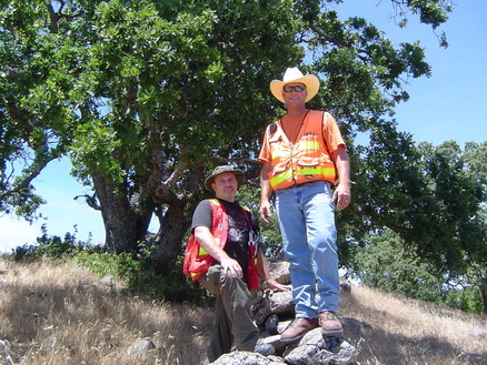
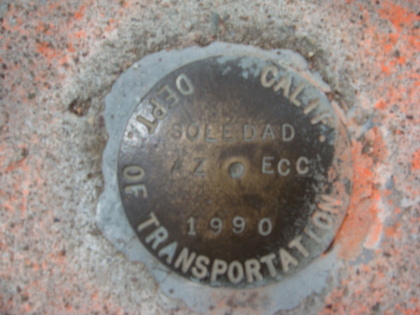
 Steven Heise -PLS and Dustin Jones- LSIT,boundary survey in Santa Clara County, California
 This is one question I seem to be hearing more and more lately, “Why are boundary surveys so expensive?” Understandably, this is one of the more common questions and there are a number of reasons. In most cases the time spent "behind the scenes" acquiring record information, researching deeds and maps, compiling field and record evidence, calculations, drafting, and preparing reports and deed descriptions can far exceeds the time spent on the site making actual field measurements and finding monuments. Now, that being said, it is the responsibility of the Land Surveyor to find existing monuments and to make an exhaustive search to locate any known record monuments, before re-establishing boundary lines. The answer to boundary surveys seldom lie in the math, it is the Land Surveyors responsibility to resolve the boundary holding the intent of the original record that created the property. This ratio between time spent on the site and time spent on research, in the office and around the site varies depending on several factors. For example, a small lot with several abutting properties may require less field time to locate boundary evidence because of the relatively close proximity, but may require the same amount of off-site work as a much larger parcel, or vice versa. It may take a day to find and locate field evidence, and 4-6 days of the "behind the scenes" work to complete the survey. There are countless legal and boundary principles to apply, verify and check before completing the survey.
The cost of a boundary survey can depend on so many of the variables of the property being surveyed; size, shape, terrain, vegetation, and the amount of existing survey records in the area. The surveying process can be very similar to placing pieces in a puzzle. The first step in the process is to obtain copies of all the survey records and deeds in the area of your property. This can take several hours and depending on the age of the documents even days. The Land Surveyor is required to look at all adjoining properties, right-of-ways, and water boundaries, easements, street closures and dedications, to determine how your piece of the puzzle fits in with the adjoining pieces. Given a legal description of the property and all adjoining properties, the Land Surveyor locates the property on the ground. Once the fieldwork is completed, a Record of Survey Map is prepared that will be recorded at the County Surveyors Office. Each County Surveyors Office also requires a fee to record the survey. This fee is paid by the client directly to the County and is generally in addition to the fee for services charged by the Land Surveyor for his work.
In most cases a Land Surveyor's hourly rates are at or below hourly rates of similar Professions and are more in line with that of tradesmen such as carpenters, electricians, plumbers, and auto mechanics, none of whom assume anywhere near the kind or amount of liability a Land Surveyor does. If a tradesman makes an error, he will likely be required to go back and fix the resulting problem. The resulting problem from a Land Surveyor's error may be a multi-million dollar commercial building being built in the wrong location, or a costly legal battle with an angry abutting property owner. Rarely can a Land Surveyor simply return and fix the problem resulting from an error. The Land Surveyor is a Licensed Professional and it is his responsibility to find the best resolution of the property boundary, which will hold up under the scrutiny of Law. After all property disputes are well documented throughout history and can easily be found or studied in Boundary Case Law. Our courts decide countless boundaries annually. The role of the Land Surveyor is to Monument the legal boundary on the ground and through a recorded instrument, which justifies the procedures and principals used to support his findings.
The cost of a boundary survey in California is a very small percentage when compared to the price of the land being surveyed. The liability assumed by the Land Surveyor is for that piece of real property. So, when choosing your Land Surveyor please make sure that he is covered by a Professional Liability Insurance Policy and use the California Department of Consumer Affairs Board For Professional Engineers, Land Surveyors, and Geologists - License Look Up website to check his status, here is the link: http://www2.dca.ca.gov/pls/wllpub/wllqryna$lcev2.startup?p_qte_code=ENG&p_qte_pgm_code=7500.
It is my intention to help you understand the role of the California Licensed Professional Land Surveyor and the scope of services he provides.

 RSS Feed
