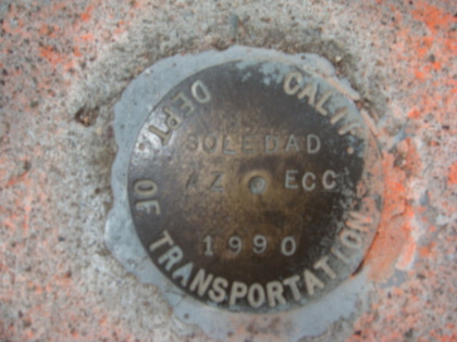
Monument Located on Mount Soledad, La Jolla CA - Photographed by Steven Heise,PLS
In In keeping with my last post I am once again going to lean on a recently published brochure from The California Land Surveyors Association. This one is in regard to
“ Survey Monument Conservation – What Does It Mean To You ? ” This brochure was published to help explain the importance of Survey Monuments and the Legal implications of their destruction. Again, a lot of this information is not common knowledge and my hope is that it will help explain the role of the California Professional Licensed Land Surveyor, how he can help you and explain a little about what he does.
What are Survey Monuments?
The corners of parcels or lines of easements can only be visualized on the ground by setting markers, or survey monuments. A survey monument is a physical
marker that locates a corner or line on the ground.They can be on a line or offset from a line, on, above or below the surface, noticeable or almost invisible. These
markers can take many forms, some more durable thanothers:
— a chiseled cross in a sidewalk set 60 years ago
— a nail and brass tag under 2” of pavement
— iron pipes of any diameter driven into the ground, either buried well below the
surface or visible at the surface
— wood stakes or posts, with or without identifying tags
— old nails or “X” scribed in concrete
— rebar, with or without identifying caps
— a scribed stone or post placed in or on the ground, sometimes with a rock
mound around it
... the list goes on.
Why are Survey Monuments Important?
Existing monuments are used to maintain the integrity and continuity of adjoining properties, neighborhoods, subdivisions, roads, highways, cities, counties,
states, and even countries. The land surveying community has observed an increase in the mortality rate of survey monuments set for right of way control, public, and private property boundaries. With their destruction, the potential for
conflicts and uncertainty of boundaries arises.
How Can a Land Surveyor Help?
You may be able to recognize a survey monument set at or above the surface of the ground. But your local Land Surveyor is experienced and qualified to research
and properly identify what markers may still exist near your project – and to find and recover them without destruction!
What are the Benefits of Monument Conservation?
4 Protection of Rights - Survey monuments protect the rights of property owners,
easement holders, and their adjoiners.
4 Keeping the Law - Malicious removal or destruction of survey monuments is
against the law.
4 Stability – Survey monuments provide stability and balance of interests in real
property.
4 Avoid liability! - You may be liable for the destruction of monuments caused by
your improvements.
4 Cost Savings - It costs much less to preserve a monument than it does to
replace it after it is destroyed.
4 Tax Savings – Resetting road, property or easement monuments after a public
improvement project adds significant costs which will ultimately be borne by
the tax-paying public.
4 Preserve Original Locations - Property lines and easements can be easily
identified in their original location when monuments are preserved.
4 Stay out of Court – Avoid possible civil actions based on unknown boundary
locations when monuments are preserved.
How to Avoid Monument Destruction & Penalties
Use the skills and expertise of your local Land Surveyor! He or she can provide the following services to conserve survey monuments before and after construction...
Before Construction or Project
4 research - research record information for existence of markers and
benchmarks
4 locate & identify – search for and find existing markers and benchmarks,
whether visible or buried
4 reference – set reference marks to original monuments that will remain
throughout and after construction
After Construction or Project
4 replacement – set replacement markers in original position using reference
marks if original monuments are disturbed or destroyed
4 document – file proper documentation with the proper agency(ies) showing
original and replacement monuments
4 preservation – set protective posts or structures near monuments for future
identification Be sure to obtain copies of the Surveyor’s documentation and/or
take photos of monuments,whether original or replacement monuments.
REMEMBER – $1 of prevention is worth $10 “cure” - replacing a monument AFTER it is destroyed takes 10 times the cost to protect it BEFORE it is destroyed.
Excerpts from California Laws Relating to Monument Conservation
Business & Professions Code
(Land Surveyors Act) §8771.
(b) When monuments exist that control the location of subdivisions...roads, streets or highways...the monuments shall be located and referenced by or under the direction of a licensed land surveyor or registered civil engineer prior to the time when any streets, highways, other rights-of-way, or easements are improved, constructed, reconstructed, maintained, resurfaced, or relocated, and a corner record or record of survey of the references shall be filed with the county surveyor....
...It shall be the responsibility of the governmental agency or others performing construction work to providefor the monumentation required by this section...
Business & Professions Code
(Land Surveyors Act) §8725
...It is unlawful for any person ...to set, reset, replace, or remove any survey monument on land in which he or she has no legal interest, unless he or she has been licensed or specifically exempted from licensing under this chapter.
PENAL CODE
§605. Every person who either:
1. Maliciously removes any monument erected for the purpose of designating any point in the boundary of any lot or tract of land, or a place where a subaqueous telegraph cable lies; or,
2. Maliciously defaces or alters the marks upon any such monument; or,
3. Maliciously cuts down or removes any tree upon which any such marks have been made for such purpose, with intent to destroy such marks; Is guilty of a misdemeanor.
Government Code §27581
All monuments located in public highways shall be placed with the top not less than 12 inches below the surface of the ground, but when not located in public
highways, they shall be placed with the top six inches above the surface of the ground...
Note: These excerpts from California law have been edited to provide relevant portions in a limited space. You must refer to the complete text of the statutes and laws for full meaning and context.
Well, this brochure is a very good introduction to Survey Monuments, their importance and the legal implications of destroying them. If you have any question please call or email me and I will be able to further discuss any questions you may have.
Steven Heise, PLS
Geomatics Engineering Inc.
Tel: (619)-218-4520
Email:[email protected]
Thank You to the California Land Surveyor Association for keeping us informed.
 RSS Feed
